
THE ARCHIVE
The Blood of Dawnwalker Map Guide & Locations
As of September 5, 2026, this page tracks 12 named world and location entries across Vale Sangora; that catalogue is not a claim of 12 regular map regions — the fictional 14th-century valley in the Carpathian Mountains where the game is set.
Blood of Dawnwalker map size and playable scope
Quick answer: PowerPyx's September 2 launch guide reports an open-world land area of about 10 km², roughly 4 km from top to bottom and 3 km across at the widest point, with a narrower upper half. Treat those numbers as a third-party map measurement, not a publisher specification or a measurement made by this site.
The same guide counts 10 regular map regions and reports that travel is on foot, with no horse. Shapeshift, Mercurial Fervour and fast-travel Shrines can shorten journeys. The publisher's earlier traversal brief also says there is no horse and describes settlements, swamps, forests, mountains, caves and meadows across Vale Sangora. PowerPyx's full world map and measurement; official traversal description.
Why this page lists 12 rows: the catalogue below is a mixed list of named world spaces and locations, including Anachora and Greifberg Castle. It is not a claim that the playable map has 12 regular regions. PowerPyx's ten-region list also prints one name as "The Slits", while this site's existing record says "The Silts"; this page keeps its recorded spelling until an in-game label is captured rather than silently presenting the conflict as settled.
How Towers and unknown map markers work
- Do not read an indicator as a solved label. The publisher's design recap says the map is visible from the start, while important activities still need to be discovered. Entering an area can reveal an indicator without telling you what it is.
- Use Towers to expose the launch map's unknowns. PowerPyx reports that climbing Towers marks locations, collectibles and quests with white question-mark icons.
- Approach and investigate. Going near an icon reportedly reveals its activity type. The publisher also points to clues, local information and travel as ways to identify activities.
Those sources describe the intended system and the launch build. If a later patch changes marker behavior, follow the current HUD rather than treating this summary as a permanent UI contract. For Shrine activation and route limits, continue to the fast-travel guide.
Static and interactive map options
| Map | What it provides | Boundary observed on September 5, 2026 |
|---|---|---|
| PowerPyx full world map | A static high-resolution in-game map with Shrines revealed. | Useful for overview and Shrine orientation; it is not an interactive pin tracker. |
| MapGenie Vale Sangora map | External interactive search and filters for landmarks, vendors, activities and items. | The public map loaded in our capture and displayed an optional Pro upgrade. Marker counts and feature limits can change. |
| Gamer Guides Vale Sangora map | External interactive category filters, labels and marker tracking. | Its page states that the free map stops at 50 markers and advertises a paid Map Pass for unlimited tracking. |
All three links leave this site. This page does not host an interactive map, reproduce their map image, promise that every marker is correct, or inherit their login and payment terms.
| Location | Note |
|---|---|
| Anachora | — |
| Boar's Back | — |
| Briar Sloughs | Home to several regional bosses (Chief Jailor, Cerbus the Scornful, and others) |
| Greifberg Castle | — |
| Laslea Glen | Coen's hometown; the prologue's setting |
| Maragir Wealds | — |
| Rockfalls | — |
| St. Tyna's Grove | Sub-area of Tantari Woods (community grouping; not verified) |
| Svartrau City | Capital of Vale Sangora; grew wealthy from the silver trade; has an underground network of cellars and ruins beneath it |
| Tantari Woods | — |
| The Silts | Sub-area of Tantari Woods (community grouping; not verified) |
| Svartrau Outskirts | — |
A dash means no additional location note was recorded. The suggested Tantari Woods grouping for St. Tyna's Grove and The Silts came from community page structure and has not been independently verified. The notes below add selected route and access examples; the index does not provide a complete navigation guide or an interactive map. See the fast-travel overview for shrine basics and the boss roster for the regional associations currently recorded.
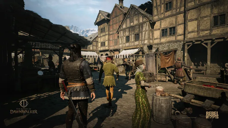
Finding your way through Vale Sangora
Laslea Glen: useful first routes
Laslea is Coen's home village; his family lives in its hills. Start with two identifiable destinations rather than wandering between unnamed markers: Anca's house for the medicine errand, and Gavril's farm for the bog and ruins route. These linked steps include the investigation clues that advance each journey. Official Laslea background.
Svartrau: streets, rooftops and underground passages
The capital's silver wealth sits above a network of cellars, caves and older ruins. Underground is another inhabited layer of the city, not a guaranteed safe shortcut. Official bulletin: Secrets of Vale Sangora.
The developer's gameplay presentation places wealthy Silberkreis near Greifberg Castle, Brencis's residence. Its cathedral example shows a clue high in the frescoes and a return at night to reach it with vampiric traversal. This is an illustrated day/night access problem: if a clue is above you, inspect the vertical route and your available form before concluding that the objective is missing. The presentation is dated June 2025, so it is background guidance rather than a verified route for every current quest. Official gameplay reveal recap.
Tantari Woods and Howling Keep
The official world bulletin places Howling Keep in Tantari Woods and presents its disappearance as local lore. For the actual quest entrance, The Cycle of Love uses a soldiers' lantern placed on a statue; see the Xanthe encounter route. Lore about a hidden mansion should not be substituted for that item-and-statue interaction. Official Howling Keep background.
What an unexplained map marker means
The official reveal distinguishes seeing an activity indicator from identifying the activity: information comes from visiting, clues and conversations. As a concrete community-guide example, Xanthe's Taste of Power activity is in a Svartrau backyard; its chest document marks another Xanthe event. Read found documents before leaving a cleared site. Official exploration explanation; PowerPyx: Court activity locations.
The catalogue above still contains 12 recorded entries. Named landmarks in these notes add context, not new counted map rows. See fast travel for shrine use; this page does not offer interactive pins or a complete entrance map.
FAQ
How big is the Blood of Dawnwalker map?
PowerPyx's September 2, 2026 launch guide reports about 10 km², roughly 4 km tall by 3 km across at the widest point. This is a third-party measurement, not a publisher specification or this site's own measurement.
Does this site have an interactive Blood of Dawnwalker map?
No. This is a location and map guide. It links to external interactive maps from MapGenie and Gamer Guides, and states the access limits observed at capture time.
Sources and coverage
- Fextralife locations list — Recorded community place names and notes; this is a name index, not a route map.
- PowerPyx: full world map — Launch-guide map dimensions, regular-region count, Towers, question-mark markers and static Shrine map.
- Bandai Namco: gameplay reveal recap — Publisher description of activity discovery, traversal and map behavior.
- MapGenie: external interactive map — Third-party map linked for reader utility; its inventory and access limits can change.
- Gamer Guides: external interactive map — Third-party surface whose captured free tier states a 50-marker limit.
Coverage date: September 5, 2026. Counts describe this site’s recorded entries, not a complete in-game total. Community summaries may omit conditions; check the source and your current game version before relying on an exact value.